
The Main Street has several trading shops, one from each occupation. The railway station sits above the road, and Dambatenne Road leads into the hills. The town is dotted with little Hindu temples, reminding us of the large population of Indian Tamils who are employed in the tea estates that cover the surrounding hillsides.
The town is considered a place that must be seen by any hill country traveller because of the Haputale Gap. This is without doubt, one of the most spectacular sights in the country. The great amphitheatre of the upper Uva spreads out to the north and east. It is bounded by the mountains of Idalgashinna, Ohiya and the Horton Plains, the peaks of Hakgala, the purple cone of Namunukula, and Poonagala and Bandara Eliya. On the other side is an equally breathtaking view Ñ the foothills of the lower Uva, the southern Sabaragamuwa and the Southern Province right down to the sea. On a bright and cloudless day, one could see the ocean as a bright blue line in the distance, but usually the horizon is obscured by clouds and mist. A cloudless night discloses the stabbing rays of the little lighthouse of Hambantota, far south.
Though one can experience this spectacular view from anywhere in the town the ideal place where one could see five provinces at the same time, is near the one kilometre marker on the Dambatenne Road. I had to walk up the lonely hillside, where after about 300 metres one gets a birdÕs-eye view of the whole town. By the one kilometre marker, I stood facing south-east, and at my right hand stretched the Sabaragamuwa Province, while at my left the indistinct features of the Eastern Province could be seen. Right in front of me, I could see the lakes and reservoirs of the Southern Province, as well as the verdant green paddy-fields, nestling among thick jungle areas. Behind me was the Central Province and the mountains of the Pidurutalagala range and the Uva mountains.
If one has the time it is certainly worthwhile to take a drive along Dambatenne Road as it is one of the most scenic stretches of road in this country. This six mile stretch of road ends in a cul-de-sac on the other side of the Poonagala-Ampettikanda range. Far down in the valley below, is a gigantic gap between two mountains, and everywhere there are streams and waterfalls and hills that rise up majestically to over 6000 feet. Beyond and below the gap is the road to Koslanda and Wellawaya and around it the basin of one of the mainstreams of the Walawe river. Above the road and to its left is the Haputale Forest Reserve, which is well served by streams and is ideal for camping, except during the rainy season or in January or February, when mist reduces visibility almost to nil.
Five miles from Haputale is Idalgashinna, a tiny hamlet on the railway. At a height of about 5300 feet, it boasts a truly spectacular view on both sides of the railway line. To appreciate the beauty of the place, one needs to get off the train and spend at least a few hours absorbing the tranquillity of the place, perhaps seated at the top of the small hill behind the station as I did. The view from the top of the hill is magnificent, and I could see the mist rising up from the valley below into my face. The sound of the mist and wind among the trees evokes images of pine trees murmuring the timeless beauty of Idalgashinna. The hills fall perpendicularly downward and a false step could easily send the unfortunate plunging downwards to their death. It is an enjoyable walk along the railway line back to Haputale. Stretching for five miles between Haputale and Idalgashinna is a little known nature reserve Ñ the Tangamalai Wildlife Sanctuary. Not many large animals are to be seen, but birds of bright hues can be seen in profusion. From behind the railway station, a gravel track takes off, skirting the other side of the ridge, traversed by the railway line on its way to Ohiya. Five miles beyond, it joins the Boralanda-Ohiya-Kalupahana road, two or three hundred yards below the Ohiya Gap.

About three miles below Idalgashinna station, the southern slope of the range and surrounded by the Needwood Tea Plantation is an old abandoned fortress, the Kotugodella Fort, at an elevation of about 3800 feet. The Portuguese once attempted to use the Idalgashinna Pass to force a way into the Uva. Hardly anything of the Fort remains today; a few scattered stones and the semicircular outlines of ancient bastions are the only reminders that such a majestic structure once stood there.
Those who love walking could take a hike from Haputale to Ohiya station which sits at an elevation of about 6000 feet. The Ohiya Pass is not as scenic as the passes at Haputale and Idalgashinna, since the view is only on the southern side of the range, the other side being in forest. From the head of the Gap to the station is a stretch of two delightful miles through avenues of eucalyptus, and cypress. The Gap looks out to the Horton Plains massif to the right and over the steep descent to the main road to Haputale below. Far down in the valley below is the 4900 foot peak of Bambaragala. If one is taking the train from Bandarawela to Ohiya, there are two trains at 7.20 a.m. and 10.20 a.m. The only train from Ohiya back to Bandarawela or Haputale is the ÔPodi MenikeÕ which arrives at Ohiya station at about 2 p.m. If one misses this train, it becomes necessary to take the bus to Nuwara Eliya and from there take another bus to Bandarawela or Haputale.
The Ohiya Gap may not be as spectacular a sight as the Haputale and Idalgashinna passes, but is distinct in its utter loneliness, where one may not meet more than half a dozen people in a whole day.
From the station there is a dirt track leading upwards where 11 kilometres later it leads to the Farr Inn, a popular stop before travellers venture out into the beautiful and desolate Horton Plains. This area is haunted by many species of deer and if one is lucky, at night, one might see sambhur (elk) as well.
A 14 kilometre walk, along the railway track from Haputale to Pattipola, the highest station in Sri Lanka, takes the hiker through utterly desolate landscapes with blue and red gum trees and winding vines with almost luminously blue-green leaves that entwine around taller trees. There is not a soul to be seen, and the atmosphere is often misty and at times visibility reduces to a few feet ahead of you. If one decides to do this hike, it is advisable to take a good torch, as many of the tunnels are quite long and walking in the darkness could lead to sprained ankles or worse.
Close behind the Haputale station is the Buena Vista Hotel, a grand old hotel of bygone days perched on the edge of the mountain, which sadly has been converted into an office. Below the station can be found a house that used to belong to Sir James Peiris. Sitting on a hill above the town are St PaulÕs Catholic Church, and a short distance away, St Andrews Anglican Church. This quaint green-roofed church, boasts a beautiful stained glass of the children coming to Jesus. In its cemetery, can be seen ornate gravestones of many of the English planters and their family members who used to come to the church. A notable grave is that of Walter Stanley Senior, the writer of the beloved ÔHymn for Sri Lanka.
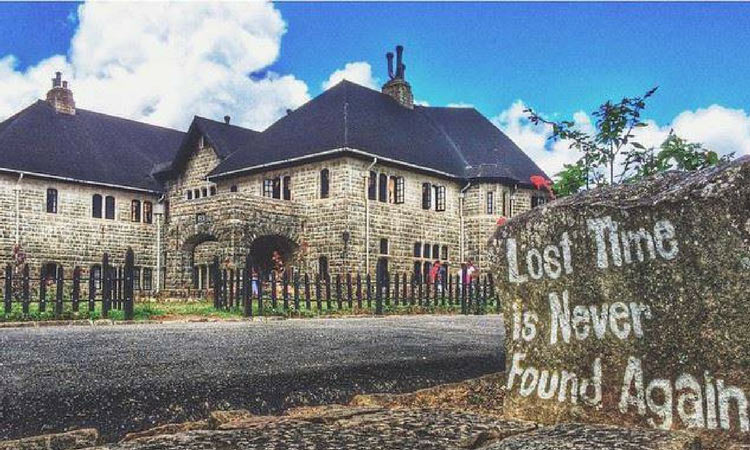
A few kilometres along the Colombo - Badulla Road, one comes to a turnoff leading upto the monastery of the Sylvestro Benedictine monks, called Adisham. This large stone building, initially built by Sir Thomas Lester Villiers, a tea planter, was sold in 1931 to the Benedictine monks. Novices are trained for a period of a year at this monastery. There are a few rooms for occupation by outsiders, but these are kept strictly separate from the quarters of the novice monks. ÒThere are many sightseers who come here and make a big disturbance and even shout at us if we donÕt show them round the entire building, including the quarters of the monks which are strictly out of bounds for visitors,Ó said Rev. Fr. Bernard Ramanayake, Father Superior of the monastery. Those who wish to spend a few days in the quiet environment of Adisham, must write to Father Bernard who would then consider the request. The gates are closed at 4.30 p.m. after which no outsiders can enter the premises. Residents need to tell the monks if they are going to be out late.
A visitor to Haputale can stay at either the Haputale New Rest-house, which is one kilometre from the railway station, or the Old Rest-house which is opposite the station. There are also numerous houses which offer accommodation and meals for reasonable rates but one needs to search for them. An alternative would be to stay in a nearby town, such as Diyatalawa or Bandarawela, and drive, take a bus or walk the 10 kilometres to Haputale. Unless you have an unlimited supply of patience, many days to enjoy the hill country, and donÕt mind spending a substantial amount of a day on the train, it is not advisable to take the ÔPodi Menike ExpressÕ which leaves at 5.55 a.m. from the Fort Railway Station. This took 9.5 hours to reach Haputale station. Even though it was a prolonged train ride, it would nevertheless be enjoyable to a die-hard train buff like myself.
The alternative trains are the ÔUdarata MenikeÕ which leaves the Fort Railway Station at 9.45 a.m. and the Night Mail train which leaves the Fort Railway Station at 8.30 p.m. Other alternative transport methods include a normal bus or the Intercity Express bus service, which is about double the fare of a normal bus.

No comments:
Post a Comment